Eruv in the Contemporary City
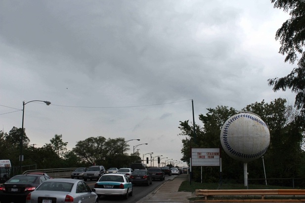
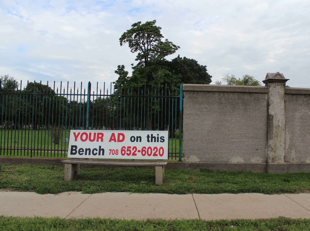
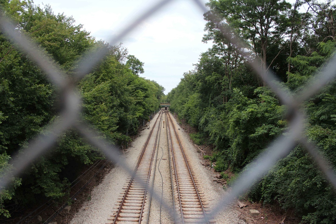
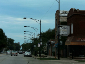
The West Rogers Park EruvAt around 3.5 square miles in area the West Rogers Park is a moderately sized urban eruv, which encloses a densely populated neighborhood along the northern boundary of the City of Chicago. According to Chicago eruv Inc. the boundary of the eruv are on the west the Kedzie Ave. side of the Chicago River Fence, on the north side the Skokie Swift Train Tracks, on the east side the Chicago Northwestern Railroad Tracks, and on the south side the Rosehill Cemetery Wall, wires that run on the south side of Peterson Ave. until Lincoln Ave and along Lincoln Ave. until the Chicago River.
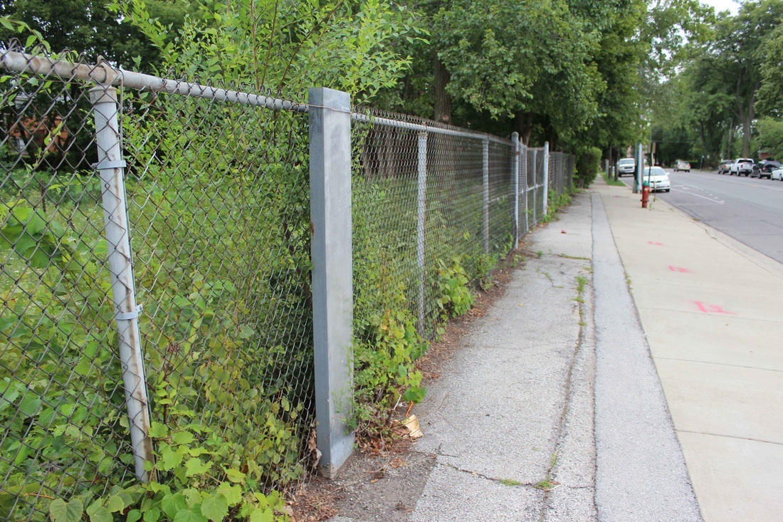
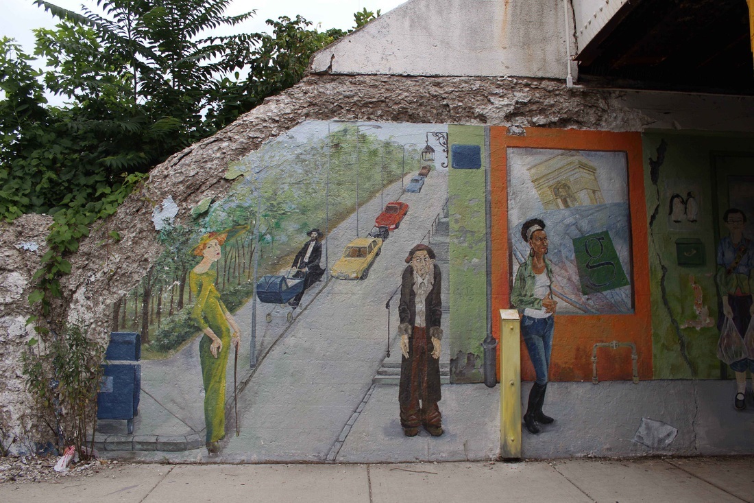
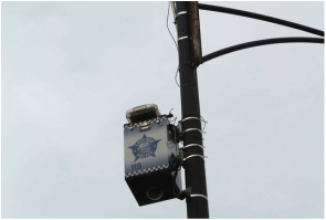
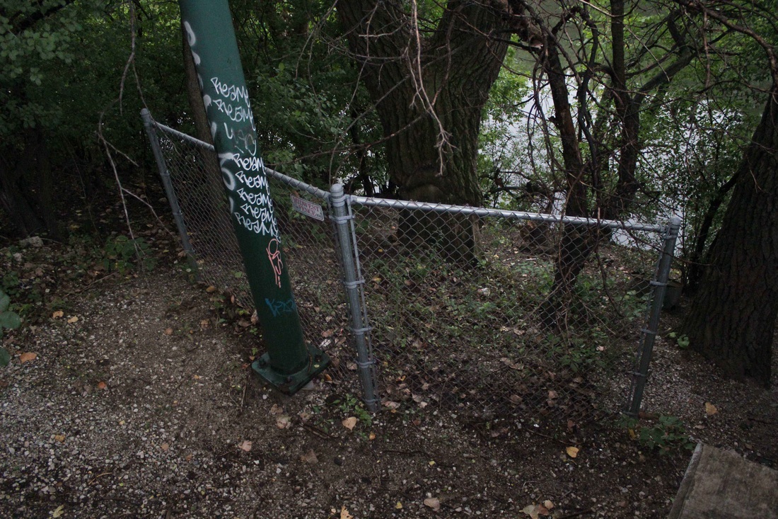
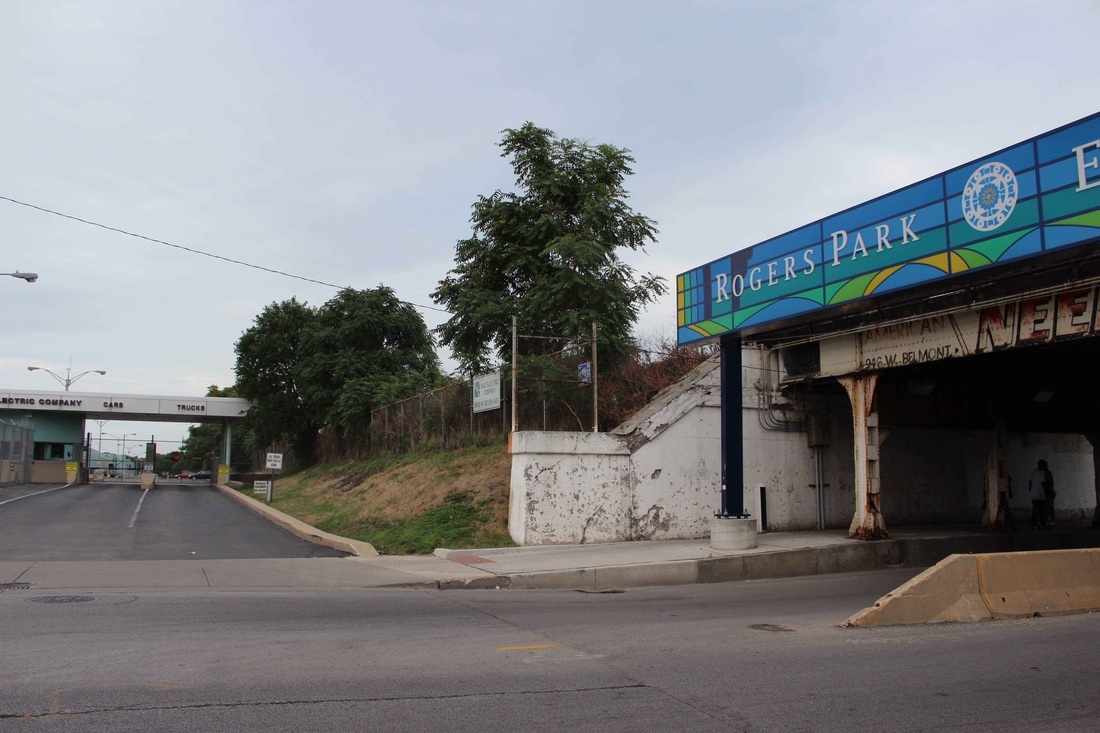
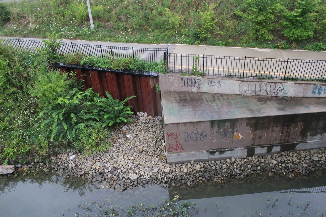
Although this boundary generally defines the path of the eruv it does little to illuminate the variety of elements used to build it. The path holds many small nuances and layers multiple forms of enclosure to ensure that it does not fail. This is one of the reasons that the West Rogers Park eruv considers itself a 3-walled “city”. The topographic and structural nature of its construction and the processes that define its weekly maintenance are intimately tied to this view and to the social and political processes of its specific location. In West Rogers Park, the eruv was conceived of and is maintained by a committee with expertise in law, real estate, engineering, halacha, and local politics. As a result the eruv’s physical characteristics express a strength and permanence unseen in many other eruvin. Braided steel cable, capable of withstanding Chicago ice storms is used in place of fishing line. Utility poles are specified as lechi that meet or exceed city standards and are sunk with concrete footings. Multiple people reported to us that the eruv once saved a mans life. When a cab driver ran in to and broke a city utility pole, the braided steel cable attached to the top and used to create the eruv, held up the pole and it did not fall on to the driver or into the busy street. The eruv is constructed to have multiple layers of protection against potential failures, as can be seen in the industrial canal the community uses as one of its boundaries. In the case of the canal, the revetments beneath the water can be used as an eruv wall, however, when the water freezes it was questioned if the revetments could still be used. As such, the community surveyed the banks to ensure that they had the requisite slopes to serve as a boundary during the winter months. The strength and layers of the West Rogers Park eruv have made it an accepted part of the city’s space. A series of murals in West Rogers Park cover elements of the eruv and help it to blend into its surroundings. The eruv uses multiple parts of the communter rail system, both embankments and power lines. The walls of a cemetery, a canal, and power lines are augmented and slightly altered to serve the purposes of the Jewish community. New construction adds to the eruv’s strength and is an expression of the community’s position and expertise. The eruv is a physical palimpsest of the group that created it, on which other groups have projected their conceptions of the city and under which others live their lives, unaware of its existence. Text by Isaac Cohen View Tour 3: Affect in a full screen map To better understand eruv, one must first understand the basics of how enclosure is defined by Jewish communities. (It is important to note that various units of measurement and interpretation of enclosure are used by different communities based on their specific Rabbinic tradition.) The two units of measurement used are Tefach (handbreadth) between 8cm and 9.6cm and Amah (arm length) between 48cm and 58cm.
The challenge of eruvin is to transform public and carmelit spaces into private space. This is accomplished at a wide range of scales, from a backyard to a large swath of a city; in the case of Los Angeles eruv space is around 80 square miles. The operation used to transform these spaces is to enclose, with walls, doors, and doorways (the basic elements of a home or private space) on at least three sides. Another set of definitions is important at this time in order to understand how urban spaces are enclosed.
Using these basic elements and under the guidance of a Rabbi with specific training and expertise on the topic of eruvin a community can go about identifying structures and geographic elements within their cities that can create a boundary around their community. This involves mapping existing structures (buildings, fences, creek/river banks, hills or mountains, canals, highways, train tracks, etc.) that can be used as walls/doors and elements (light poles, power lines, traffic lights, telephone lines, trees, buildings, etc.) that can be used to construct doorways. After these elements have been identified, they must be physically marked as part of the eruv or connected with new material (fishing line, wire, metal posts, fencing, string, etc.) to create the posts and lintels of a doorway. |
This tour will explore the Rogers Park eruv, that Isaac Cohen describes as “a physically constructed Rabbinic infrastructure that utilizes elements of the city, both civic and structural, to define public and private spatial domains.” Architectural historian Jennifer Cousineau writes, “An eruv is a space whose disparate areas are regarded as forming a single domain by virtue of the contiguity of its boundaries. An eruv can be built in a sin¬gle street, uniting several dwellings on that street, or on a much larger scale, uniting many streets, households, and even neighborhoods. All eruvim, how¬ever, require real, physical boundaries. These boundaries tend to be mini¬malistic and are usually well integrated into the urban built environment.“
Tracing the boundaries of the eruv across Devon Avenue and walking past synagogues may help one imagine, feel and know a new and embodied experience of the material world that is otherwise not available to them. We explore how places are marked in order to reproduce spiritual practices, compliant behavior, and a sense of peoplehood. Not much happens in terms of architecture. Yet layout, sense of movement, signs, and cognitive maps create an intangible sense of place that gives meaning to the world of Devon Avenue. Isaac Cohen, Isaac Hametz, and Rae Vassar write: The following is intended to give an overview of eruv; it’s principals, construction methods, and the requirements for its inception in contemporary cities. It will also lead the reader as they view and discover the West Rogers Park eruv in Chicago, IL. The information presented here is the result of field observation, conversation, and research undertaken by A Spatial Practice (Isaac Cohen, Isaac Hametz, and Rae Vassar) during the summer of 2012 in five American cities Atlanta, St. Louis, Los Angeles, Chicago, and New York. Translated literally, eruv means mixture, involvement, or partnership. However, in practice, eruv is a physically constructed Rabbinic infrastructure that utilizes elements of the city, both civic and structural, to define public and private spatial domains. This definition of spaces is done for the purposes of the Sabbath, to allow for Jewish ritual observance so that all individuals can fully participate in the life of the community. There are 39 primary prohibitions from work on the Sabbath. These prohibitions are derived from the process of building the tabernacle. One of these activities is carrying, generally objects other than clothing being worn and objects that are medically necessary, between public and private domains or within the public domain. This prohibition creates a necessity for Jewish communities to be able to distinguish between the public and the private domains. Eruv recasts the boundary between public and private space for the reason described above. It is a physical construction that utilizes Jewish religious law (Torah) and interpretation (Talmud) to expand private space from the boundaries of the home and extends it across urban territory, enclosing an area defined by and for a local community. These constructions often require negotiation with local government entities, utility companies, and individuals for the use of private or publicly owned property for an eruv. For the eruv to be constituted, it is also necessary for the Jewish community to have permission for the use of the space encompassed by the eruv. In some cases this is as simple as an agreement between neighbors and in others it can require the leasing of land or an act of eminent domain from a municipality. These acts are required by Jewish law, given for no cost or a nominal fee to the community, and grant no power to the community except that the land is officially within the boundary of the eruv. This requirement has been a point of contention in several notable cases around the country. Another religious requirement of eruv, is that they be inspected each week by a qualified Rabbi to ensure that they remain kosher, whole and unbroken. The Rabbi must visually inspect all elements of the eruv before sundown on Friday evening. In some cases, portions of the eruv such as mountains or hillsides are inaccessible on a regular basis and are checked less frequently, in the case of the Los Angeles eruv by helicopter. This is possible because of the nature of topographic features; they are less likely to break or fall then a string or wire. After the check has been completed the Rabbi must report the to community if the eruv is up or down, thus if they can carry or not. Often the message from the Rabbi is left on a website, as a recorded phone message, or sent out on twitter for the community to check. Due to the physical and legal requirements of their constructions, the varied environments and urban forms of their locations, and the social makeup and skills of the communities constructing them, each eruvin has a unique and highly localized physical form. In some case eruvin are designed to be inconspicuous in the landscape and the materials used are nearly invisible or are camouflaged to blend in to the surrounding environment. In others, the materials are sturdy and strong, the same or similar to elements already present in the urban environment and may be overlooked as municipal infrastructure. In most cases, either because of camouflage or because they look like standard infrastructures, eruvin blend into and are incorporated into the life of the city. They are invisible to those that do not know where to look or how to see them. They are painted over by community murals, have had municipal signage added to them, been part of highway and railway construction, and are passed through by unsuspecting individuals in small towns and major cities around the world. For those who have taught themselves to see eruvin, they are a potent example of how communities can create the spaces that they need to fully participate in the life of the city and of how space is socially constructed. |